There are times when the forecast delights and times when it defies logic.
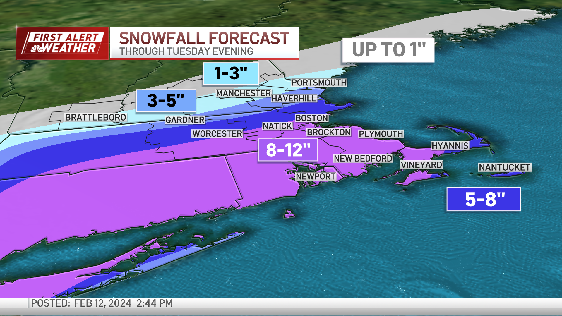
This is one of the latter. Guidance was very confident in most of the Commonwealth seeing 6 to 12 inches of snow.

As the track shifted south, the confidence vanished. Why the shift? Why the backpedaling? It’s easy to say, “Weather is variable. Changes happen.” But the crux of it is the dual jet streams influencing the storm’s track.

At first, we saw a very strong storm manipulating the steering currents as it goes along. As time went along, the storm appeared weaker (pivotal change). Now at the mercy of the steering currents, one from the north that eventually got the upper hand and shifted the storm south.
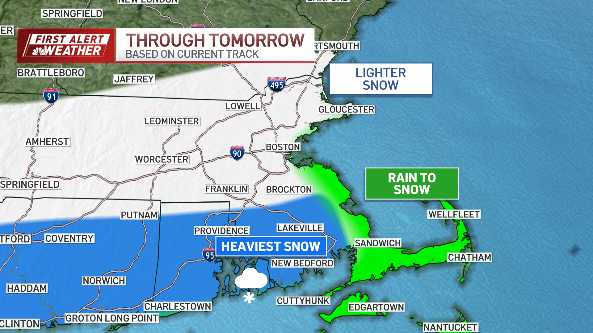
Evolution of the pattern is the weakest link in weather forecasting. The proverbial “butterfly flapping its wings” that MIT professor Ed Lorenz coined as chaos was firmly in play here. But we still have some accumulation. And there will still be some impact to travel and cleanup.
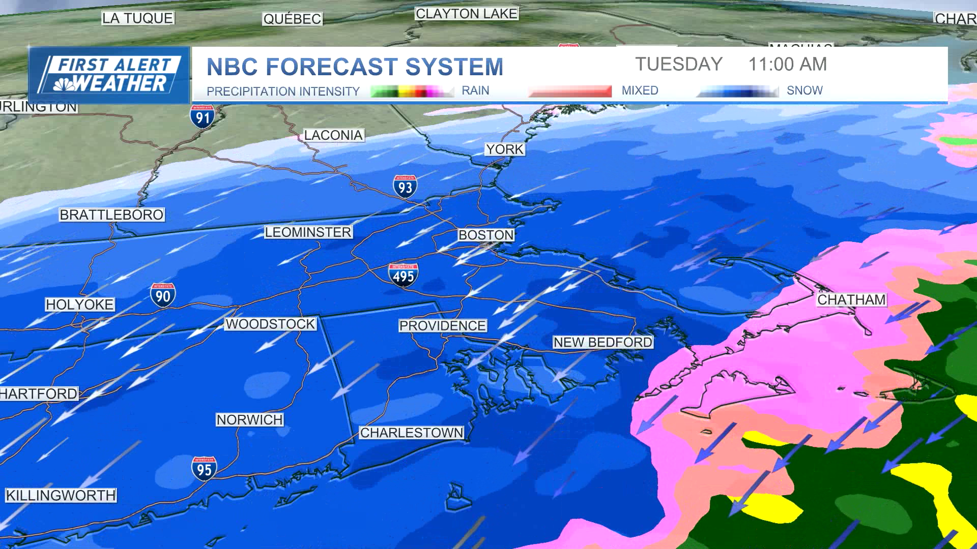
Rain will head off the start of the storm in some spots, whereas wet snow will have a hard time accumulating in others.
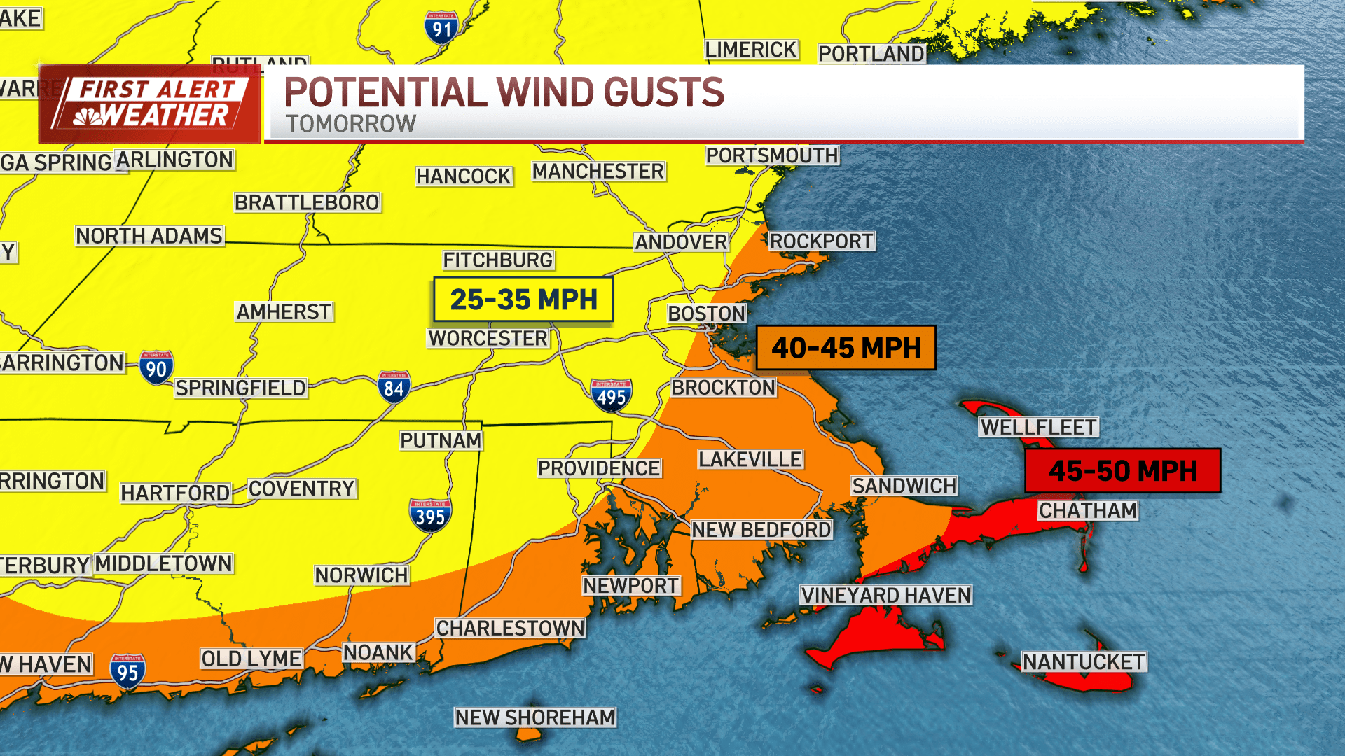
As the “meat” of the storm gets rolling toward late morning and early afternoon, we’ll switch to snow and see a majority of the accumulation. Winds will ramp up along the coast, with gusts to 40+ at the water’s edge.
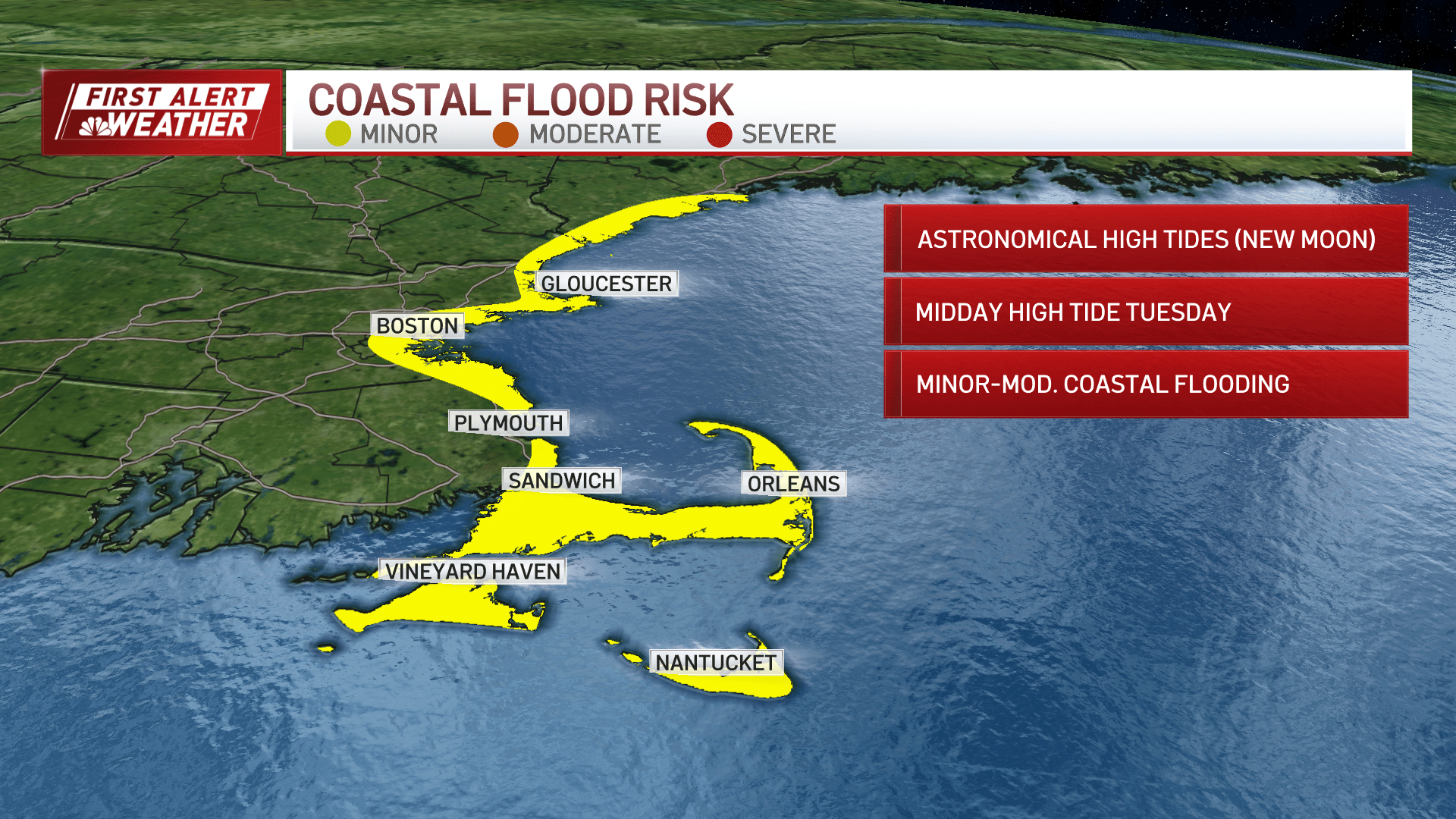
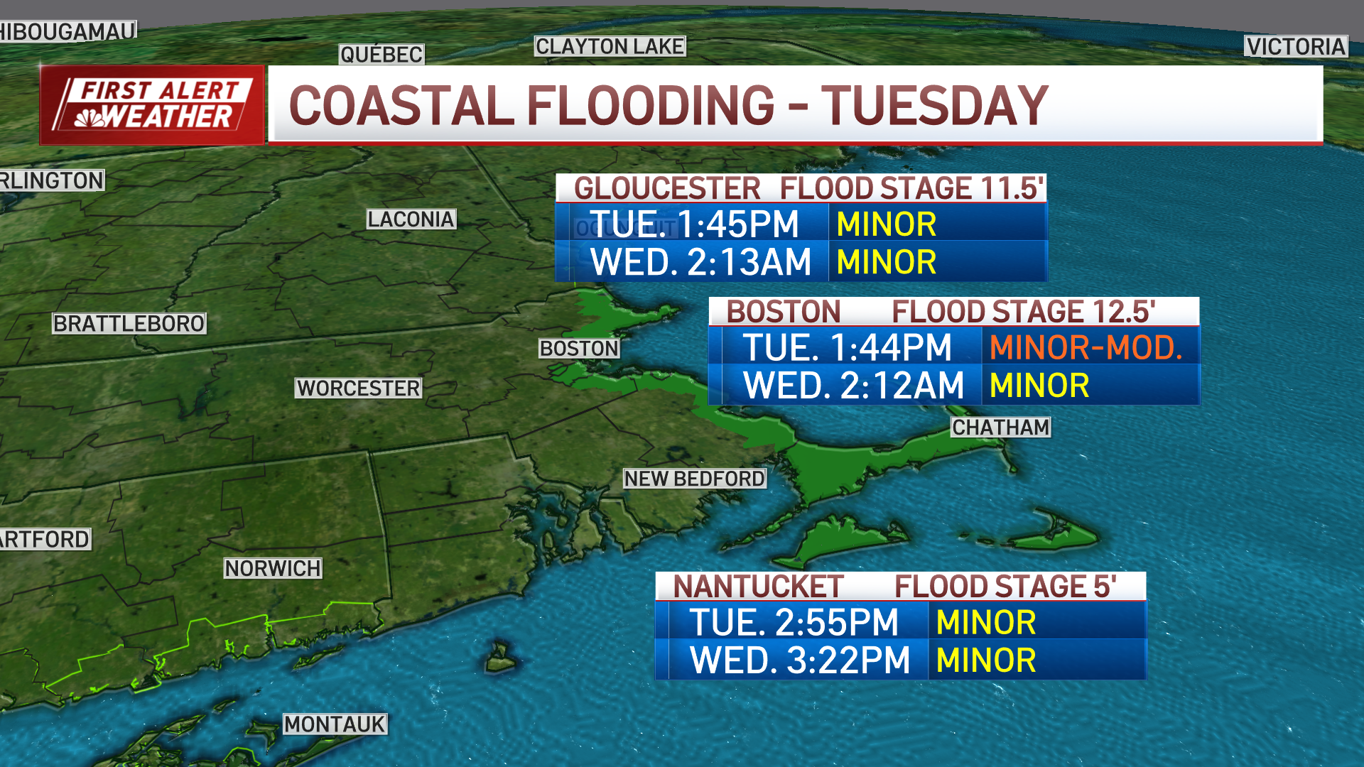
Coastal flooding is expected at the 2 p.m. high tide. We’ll be in between minor and moderate in many spots, falling short of the major flooding last month.
The wrap on the storm comes late Tuesday afternoon and this evening (on Cape).
Winds will switch around and we’re expecting temps to drop below freezing. Some slippery spots are possible Wednesday morning.
Cold remains a factor into the end of the week. We have another batch of light snow expected late Thursday and early Friday.
